
")
- Details
- Written by Hamid Reza Azimido
- Hits: 3257
The city of Shiraz is the center of Fars province. It locates in center of South bound of Iran, 888 Km away from the South of Tehran. It coordinates E52, 30 & N29, 37 and about 1550 meters above the sea. It also locates along the classic route of tourism in Iran and it forms the golden tourism triangle of Iran including Isfahan and Yazd.
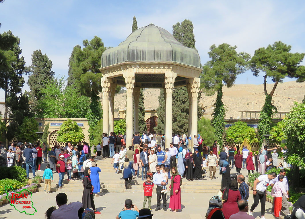
Read more: The historic city of Shiraz (The city of poem and literature)
Write comment (0 Comments)- Details
- Written by Hamid Reza Azimido
- Hits: 4616
The cultural complex of Khajeh Mountain is in the East of Iran, Sistan & Blouchestan Province, Hamoun County, 30 Km away in the South-West of Zabol, in the middle of Hamoun Lake. It coordinates at E61, 15.186 & N30, 56.390 and about 540 m above the sea level.
Read more: Khajeh Mountain (Oshida)
Write comment (0 Comments)- Details
- Written by Hamid Reza Azimido
- Hits: 3400
Bakhtiyari tribe or the great Lor are one of the greatest and the most famous Iranian tribes who had political and economic effect on the South-West of Iran. The territory of Bakhtiyari tribes is the Zagros mountain ranges between the two mountainous areas of Lorestan and Bakhtiyari from one side and the warm plain of Khouzestan in the South-West of Iran from the other side.
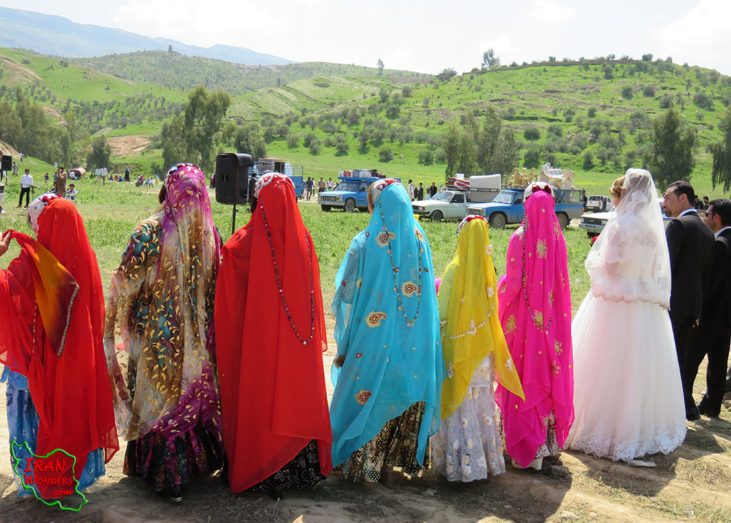
Read more: The great nomads of Bakhtiyari and Bardshirs (the stone lions)
Write comment (0 Comments)- Details
- Written by Hamid Reza Azimido
- Hits: 3113
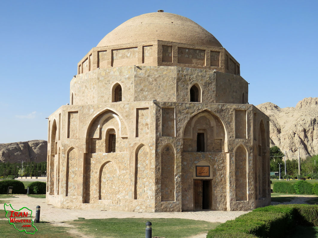
Anahita temple is in Kangavar, Kermanshah Province, on the East bank of the River Sarab, 94 Km away in the North-East of Kermanshah, on the highway from Hamadan to Kermanshah and the ancient route from Hegmataneh to Tisfoun, in the west of Iran. It coordinates E047, 57.570 & N34, 29.948 and about 1500 m above the sea level.
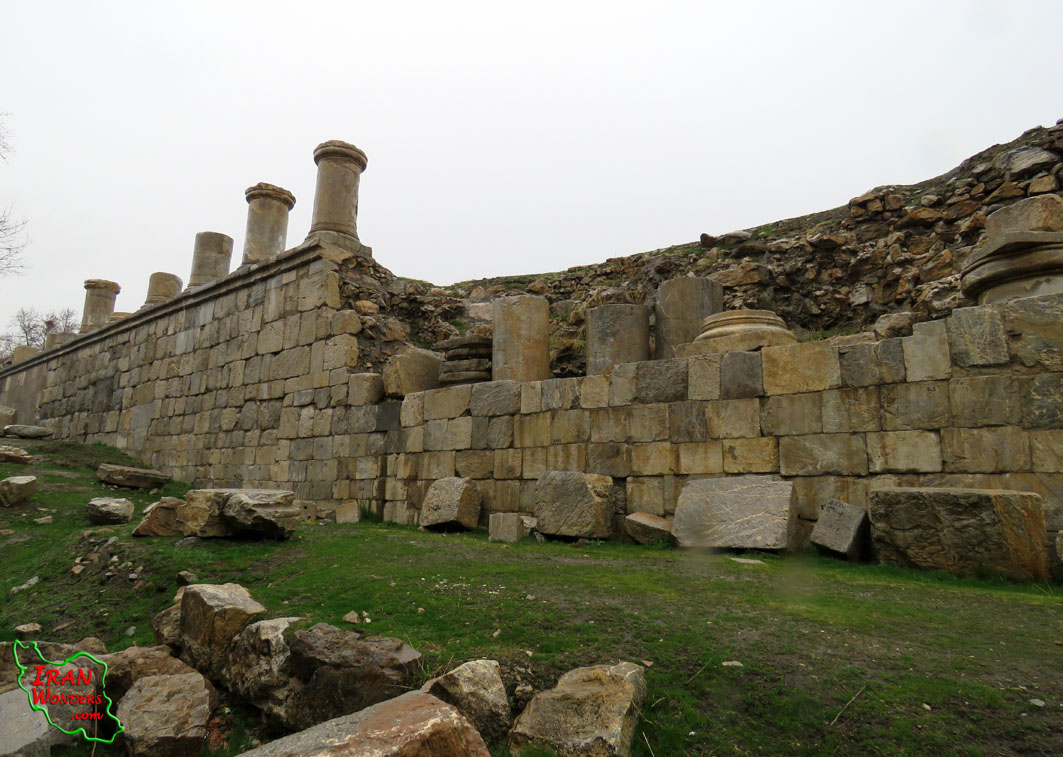
Read more: The ancient temple of Anahita in Kangavar
Write comment (0 Comments)- Details
- Written by Hamid Reza Azimido
- Hits: 3492
The archeological city of Rey is the heart of Rey the county. It is in Tehran Province, 14 Km away in the South-East of Tehran, on Tehran-Varamin highway. It reaches Tehran from North, Fashafouyeh from South, Varamin from East and South-east and Eslamshahr from the West.
Read more: The archeological city of Rey (The ancient heritage next to Tehran)
Write comment (0 Comments)- Details
- Written by Hamid Reza Azimido
- Hits: 3487
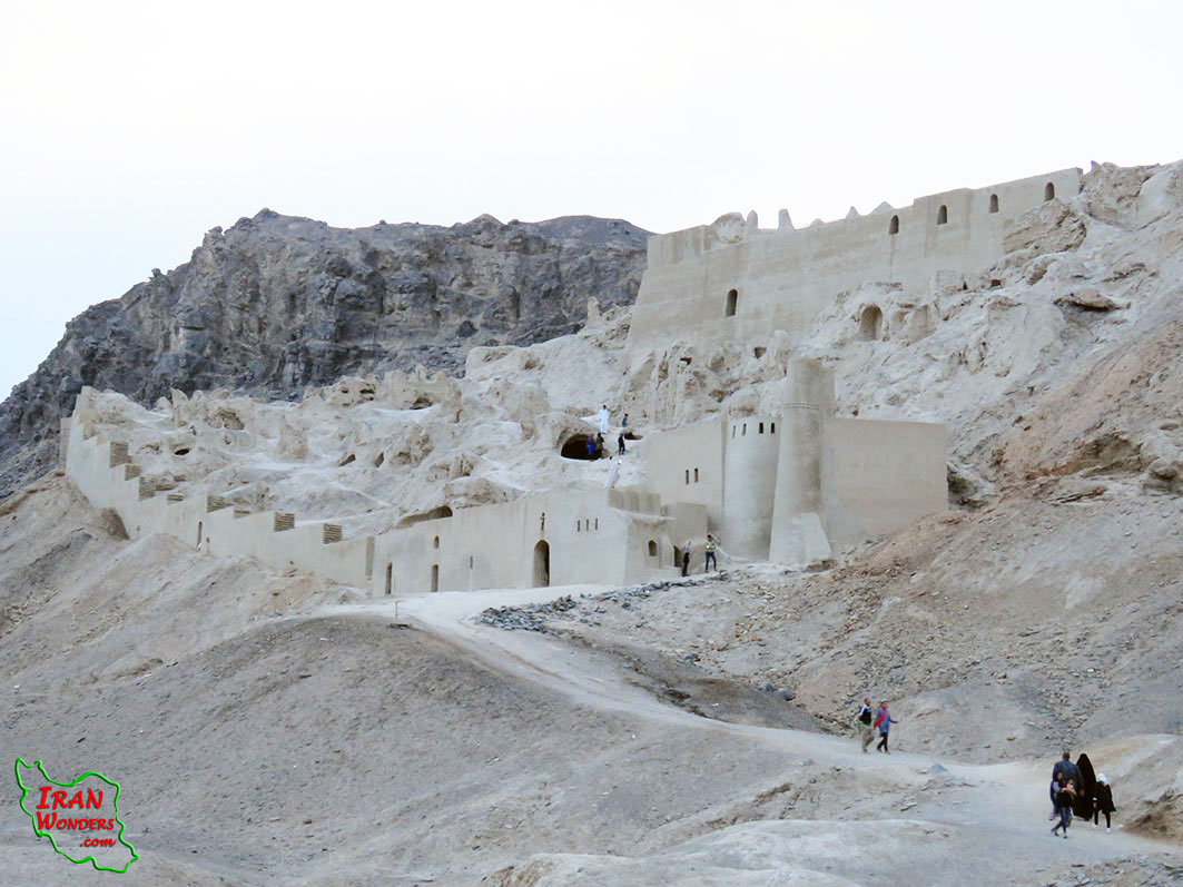
Izadkhast archeological castle is in the center of Iran, the North of Fars Province, 120 Km away in the South of Isfahan, 333 Km away in the North of Shiraz, 66 Km away from Abadeh, 60 Km away from Shahreza, next to Isfahan-Shiraz highway. It coordinates E052, 07.736 & N31, 30.791 and about 2250 m above the sea level.
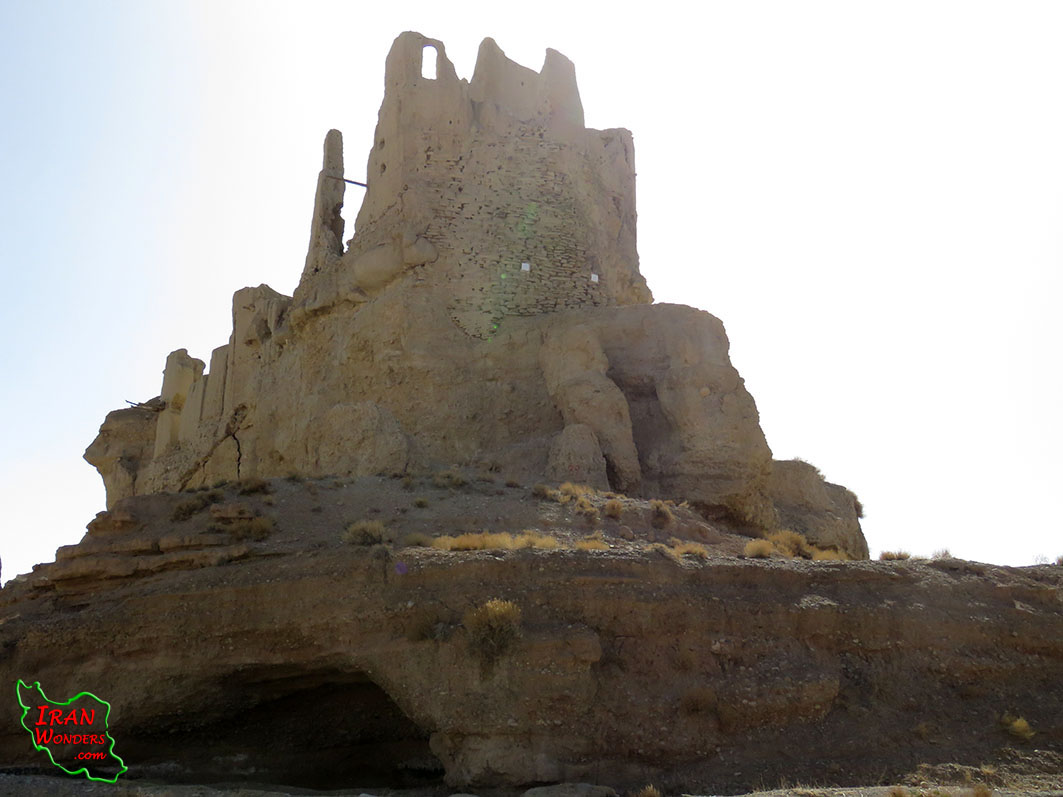
Read more: Izadkhast archeological castle (The first multi floors construction in the world)
Write comment (0 Comments)- Details
- Written by Hamid Reza Azimido
- Hits: 3184
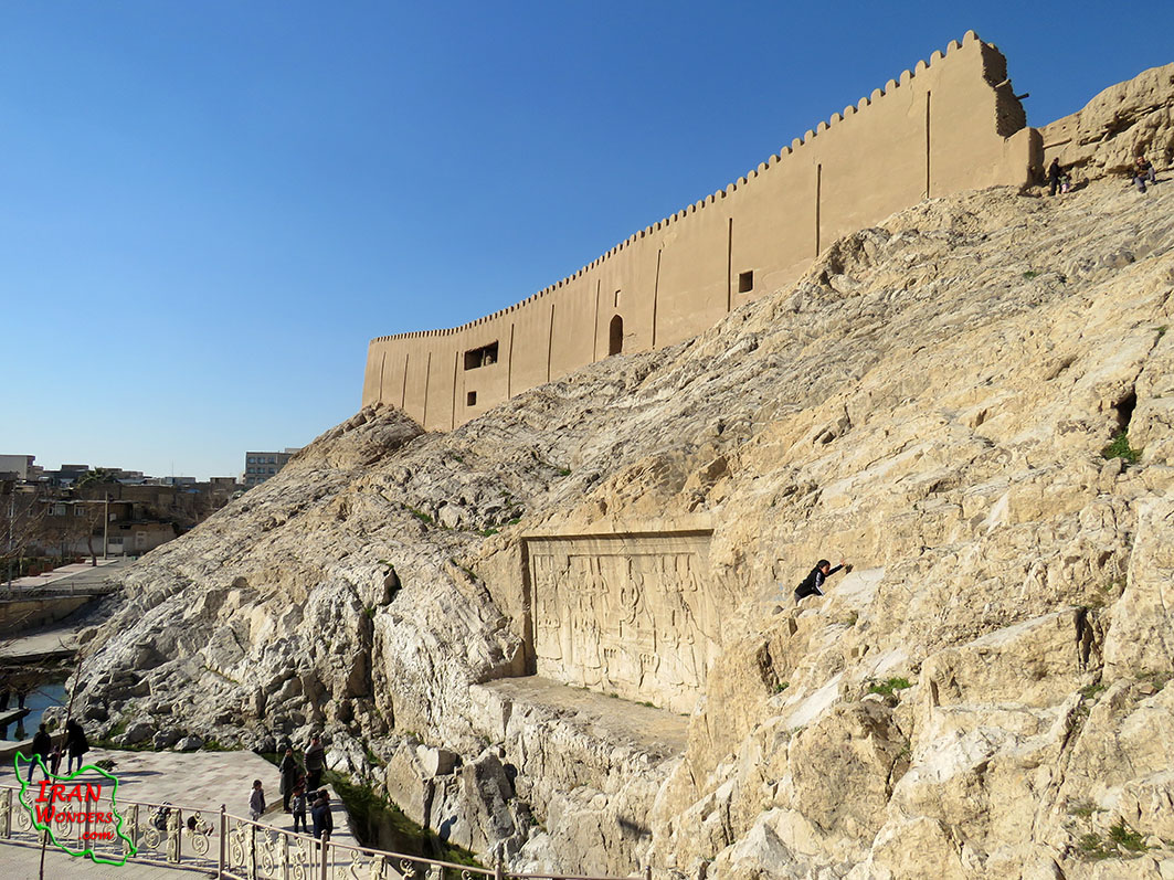
The historic city of Kerman is the heart of Kerman Province and Kerman County. It is located 1064 km away in the South of Tehran. It coordinates E57, 07 & N30, 18 and about 1750 m above the sea.
Read more: The historic city of Kerman (desert civilization museum of Iran)
Write comment (0 Comments)- Details
- Written by Hamid Reza Azimido
- Hits: 3034
The site of Yari archeological city is located near the river, Qaresou, in the North of Sabalan Summit, two kilometers away from the North-west of Pirazmiyan Village, Seven kilometers away from the North-East of Lahroud, in part of Arjaq Village, in Meshkinshahr the county, in Ardebil Province and the North-West of Iran. It is 31 Km away from Meshkinshahr and 65 Km away from Ardebil. It coordinates E047, 55.529 & N38, 33.015 and about 1100 m above the sea.
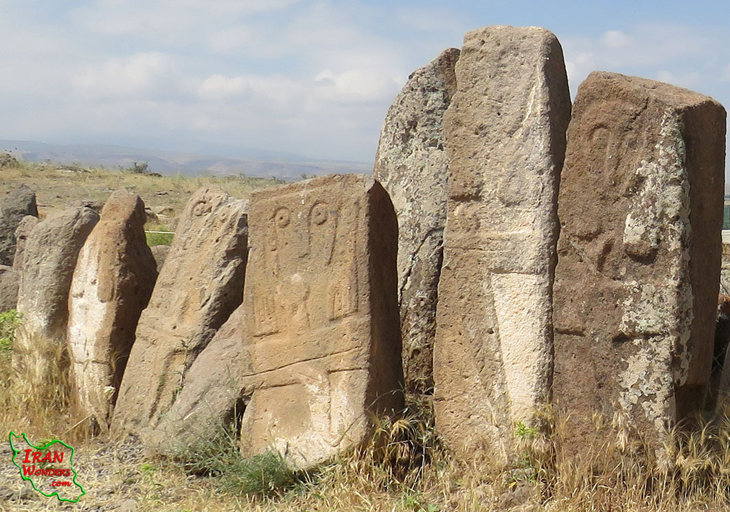
Read more: Yari archeological city (The city of stone statues without mouth)
Write comment (0 Comments)- Details
- Written by Hamid Reza Azimido
- Hits: 6802
Jolfa Iron Bridge and the borderline martyrs’ tombs of the Second World War are located on the bank of the Aras River, in the zero point of the borderline between Iran and Azerbaijan, one kilometer away on the East of Jolfa, in the East Azerbaijan province, in the North-West of Iran. It coordinates E45, 38.879 & N38, 57.027 and about 705 meters above the sea level.
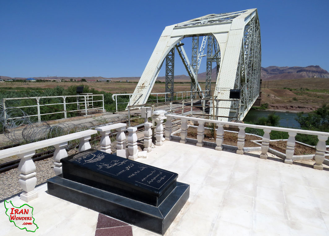
Read more: Jolfa Iron Bridge (The borderline martyrs’ tombs of the Second World War)
Write comment (0 Comments)- Details
- Written by Hamid Reza Azimido
- Hits: 4619
The remains of Desert storm event (Operation Eagle claw) still can be seen on the road from Yazd to Mashhad at E55, 53.544 & N33, 04.457 and about 850 meters above the sea.
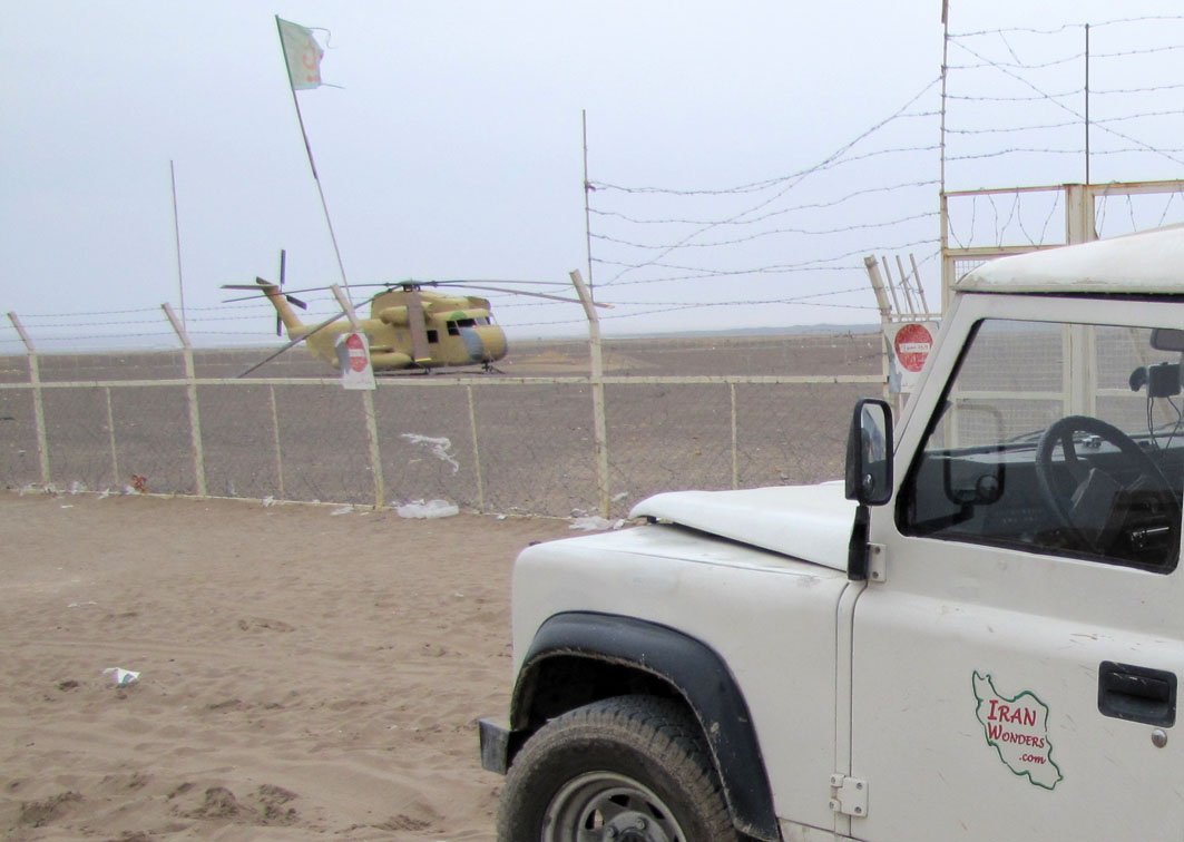
Read more: Desert storm event (Operation Eagle claw) Historic US failure in Tabas Desert, Iran
Write comment (0 Comments)